Tennessee Landforms -- waterfalls| WGS84 |
| 35.890612 | -85.217588 |
| 35° 53.437'N | 85° 13.055'W |
| 35° 53' 26.2"N | 85° 13' 3.3"W |
| 16S 660874E 3973283N |
| convert to NAD27 |
Pilot Falls 10'
Waypoint: CUF002 35.890612,-85.217588
County: Cumberland landforms of Cumberland county
popup list of
nearby landforms (mileage, bearing)
MAPS
Select one of the following maps to display this waypoint (WGS84).
GPS
Remarks:
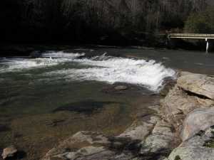
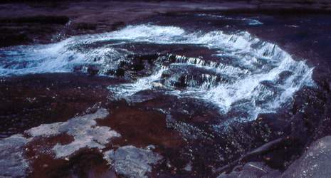 Photo by Gregory Plumb, Author of
Waterfalls of Tennessee
Photo by Gregory Plumb, Author of
Waterfalls of Tennessee
Tennessee landforms
home
arches
waterfalls
rocks
peaks
balds
sinks
lakes
regions
county
GSMNP landforms (TN/NC)
BSF landforms (TN/KY)
or nearby
lookout towers
 ©
Tom Dunigan
©
Tom Dunigan