Tennessee Landforms -- arches and natural bridges| WGS84 |
| 35.810010 | -84.980010 |
| 35° 48.601'N | 84° 58.801'W |
| 35° 48' 36.1"N | 84° 58' 48.1"W |
| 16S 682505E 3964759N |
| convert to NAD27 |
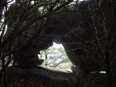
Donnelly's Window 3x2
Waypoint: CUA002 35.810010,-84.980010
County: Cumberland landforms of Cumberland county
Locale: Cumberland Trail
NABSQNO 16S-682505-3964759
popup list of
nearby landforms (mileage, bearing)
MAPS
Select one of the following maps to display this waypoint (WGS84).
GPS
Remarks:
A small window at Donnelly's overlook.
Tennessee landforms
home
arches
waterfalls
rocks
peaks
balds
sinks
lakes
regions
county
GSMNP landforms (TN/NC)
BSF landforms (TN/KY)
or nearby
lookout towers
 ©
Tom Dunigan
©
Tom Dunigan