Tennessee Landforms -- arches and natural bridges| WGS84 |
| 35.843100 | -84.950300 |
| 35° 50.586'N | 84° 57.018'W |
| 35° 50' 35.2"N | 84° 57' 1.1"W |
| 16S 685112E 3968486N |
| convert to NAD27 |
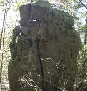
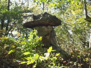
Brady Mountain Arch 7x8
Waypoint: CUA001 35.843100,-84.950300
County: Cumberland landforms of Cumberland county
Locale: Cumberland Trail
NABSQNO 16S-685112-3968486
popup list of
nearby landforms (mileage, bearing)
MAPS
Select one of the following maps to display this waypoint (WGS84).
GPS
Remarks:
A gravity arch, some small chimney's and small table rocks all in
the same vicinity.

Tennessee landforms
home
arches
waterfalls
rocks
peaks
balds
sinks
lakes
regions
county
GSMNP landforms (TN/NC)
BSF landforms (TN/KY)
or nearby
lookout towers
 ©
Tom Dunigan
©
Tom Dunigan