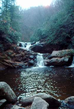
 Photo by Gregory Plumb, Author of
Waterfalls of Tennessee
Photo by Gregory Plumb, Author of
Waterfalls of Tennessee
| WGS84 | |
| 36.249700 | -82.099100 |
| 36° 14.982'N | 82° 5.946'W |
| 36° 14' 58.9"N | 82° 5' 56.8"W |
| 17S 401252E 4012204N | |
| convert to NAD27 | |
MAPS
Select one of the following maps to display this waypoint (WGS84).
GPS
Remarks:
CNF trail 39
Photo by Gregory Plumb, Author of
Waterfalls of Tennessee