 Photo by Gregory Plumb, Author of
Waterfalls of Tennessee
Photo by Gregory Plumb, Author of
Waterfalls of Tennessee
| WGS84 | |
| 36.253330 | -82.118890 |
| 36° 15.2'N | 82° 7.133'W |
| 36° 15' 12"N | 82° 7' 8"W |
| 17S 399479E 4012628N | |
| convert to NAD27 | |
MAPS
Select one of the following maps to display this waypoint (WGS84).
GPS
Remarks:
CNF trail 37
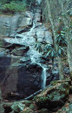
Photo by Gregory Plumb, Author of
Waterfalls of Tennessee
Dave Aldridge measures this falls at 120' to 200'.