Tennessee Landforms -- waterfalls| WGS84 |
| 35.823200 | -83.183920 |
| 35° 49.392'N | 83° 11.035'W |
| 35° 49' 23.5"N | 83° 11' 2.1"W |
| 17S 302715E 3966540N |
| convert to NAD27 |
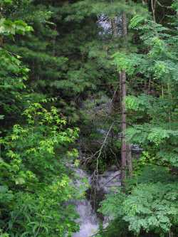
Dry Branch Cascade 30'
Waypoint: COF005 35.823200,-83.183920
County: Cocke landforms of Cocke county
Locale: Cherokee National Forest
popup list of
nearby landforms (mileage, bearing)
MAPS
Select one of the following maps to display this waypoint (WGS84).
GPS
Remarks:
wet-weather falls just off I-40
Tennessee landforms
home
arches
waterfalls
rocks
peaks
balds
sinks
lakes
regions
county
GSMNP landforms (TN/NC)
BSF landforms (TN/KY)
or nearby
lookout towers
 ©
Tom Dunigan
©
Tom Dunigan