Tennessee Landforms -- arches and natural bridges| WGS84 |
| 36.051300 | -83.080600 |
| 36° 3.078'N | 83° 4.836'W |
| 36° 3' 4.7"N | 83° 4' 50.2"W |
| 17S 312589E 3991641N |
| convert to NAD27 |
Harned Chapel Natural Bridge 35x8
Waypoint: COA001 36.051300,-83.080600
County: Cocke landforms of Cocke county
Locale: road
NABSQNO 17S-312589-3991641
popup list of
nearby landforms (mileage, bearing)
MAPS
Select one of the following maps to display this waypoint (WGS84).
GPS
Remarks:
References: C/P:36, USGS
Oven Creek passes through this natural bridge and TN 340 passes over it.
Downstream is another natural bridge.
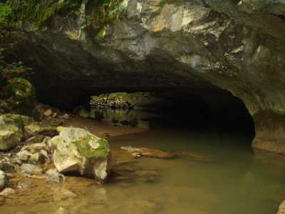
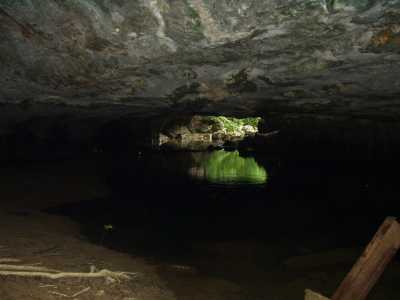
aka Little Oven
Tennessee landforms
home
arches
waterfalls
rocks
peaks
balds
sinks
lakes
regions
county
GSMNP landforms (TN/NC)
BSF landforms (TN/KY)
or nearby
lookout towers
 ©
Tom Dunigan
©
Tom Dunigan