Tennessee Landforms -- waterfalls| WGS84 |
| 36.329650 | -84.323530 |
| 36° 19.779'N | 84° 19.412'W |
| 36° 19' 46.7"N | 84° 19' 24.7"W |
| 16S 740242E 4023838N |
| convert to NAD27 |
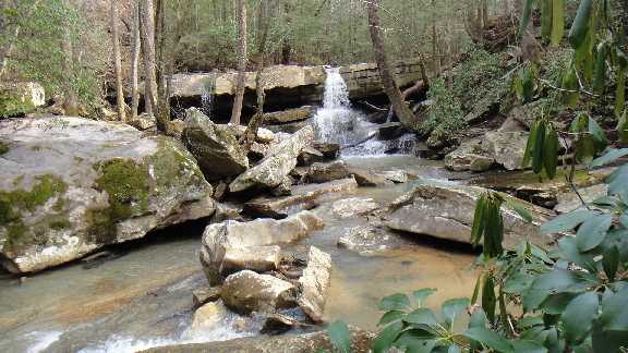
Puncheon Camp Falls 25'
Waypoint: CAF021 36.329650,-84.323530
County: Campbell landforms of Campbell county
Locale: RoyalBlue
popup list of
nearby landforms (mileage, bearing)
MAPS
Select one of the following maps to display this waypoint (WGS84).
GPS
Remarks:
Reference and photo: Dan Koerner
Tennessee landforms
home
arches
waterfalls
rocks
peaks
balds
sinks
lakes
regions
county
GSMNP landforms (TN/NC)
BSF landforms (TN/KY)
or nearby
lookout towers
 ©
Tom Dunigan
©
Tom Dunigan