Tennessee Landforms -- waterfalls| WGS84 |
| 36.474880 | -84.109610 |
| 36° 28.493'N | 84° 6.577'W |
| 36° 28' 29.6"N | 84° 6' 34.6"W |
| 16S 758966E 4040507N |
| convert to NAD27 |
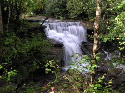
Rock Creek Falls 20'
Waypoint: CAF018 36.474880,-84.109610
County: Campbell landforms of Campbell county
popup list of
nearby landforms (mileage, bearing)
MAPS
Select one of the following maps to display this waypoint (WGS84).
GPS
Remarks:
smaller falls and cascade further downstream
Tennessee landforms
home
arches
waterfalls
rocks
peaks
balds
sinks
lakes
regions
county
GSMNP landforms (TN/NC)
BSF landforms (TN/KY)
or nearby
lookout towers
 ©
Tom Dunigan
©
Tom Dunigan