Tennessee Landforms -- waterfalls| WGS84 |
| 36.377900 | -84.176300 |
| 36° 22.674'N | 84° 10.578'W |
| 36° 22' 40.4"N | 84° 10' 34.7"W |
| 16S 753304E 4029568N |
| convert to NAD27 |
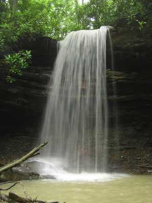
Thirteen Hollow Falls 26'
Waypoint: CAF012 36.377900,-84.176300
County: Campbell landforms of Campbell county
Locale: RoyalBlue
popup list of
nearby landforms (mileage, bearing)
MAPS
Select one of the following maps to display this waypoint (WGS84).
GPS
Remarks:
Reference: Kevin Baker
Tennessee landforms
home
arches
waterfalls
rocks
peaks
balds
sinks
lakes
regions
county
GSMNP landforms (TN/NC)
BSF landforms (TN/KY)
or nearby
lookout towers
 ©
Tom Dunigan
©
Tom Dunigan