Tennessee Landforms -- waterfalls| WGS84 |
| 36.296800 | -84.224300 |
| 36° 17.808'N | 84° 13.458'W |
| 36° 17' 48.5"N | 84° 13' 27.5"W |
| 16S 749256E 4020444N |
| convert to NAD27 |
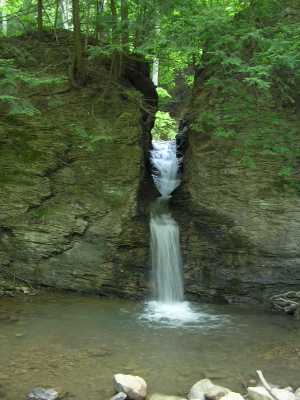
Notch Falls 20'
Waypoint: CAF011 36.296800,-84.224300
County: Campbell landforms of Campbell county
Locale: Caryville
popup list of
nearby landforms (mileage, bearing)
MAPS
Select one of the following maps to display this waypoint (WGS84).
GPS
Remarks:
Reference: Kevin Baker
 (aka, little egypt)
Tennessee landforms
home
arches
waterfalls
rocks
peaks
balds
sinks
lakes
regions
county
GSMNP landforms (TN/NC)
BSF landforms (TN/KY)
or nearby
lookout towers
 ©
Tom Dunigan
©
Tom Dunigan