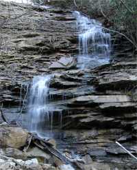
 upper falls, downstream are
main falls
upper falls, downstream are
main falls
| WGS84 | |
| 36.331800 | -84.226500 |
| 36° 19.908'N | 84° 13.59'W |
| 36° 19' 54.5"N | 84° 13' 35.4"W |
| 16S 748947E 4024322N | |
| convert to NAD27 | |
MAPS
Select one of the following maps to display this waypoint (WGS84).
GPS
Remarks:
Reference: Kevin Baker
wet-weather feeder stream to Bruce Creek above CT bridge crossing
upper falls, downstream are
main falls