| WGS84 | |
| 36.329300 | -84.226100 |
| 36° 19.758'N | 84° 13.566'W |
| 36° 19' 45.5"N | 84° 13' 34"W |
| 16S 748991E 4024046N | |
| convert to NAD27 | |
MAPS
Select one of the following maps to display this waypoint (WGS84).
GPS
Remarks:
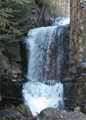
Four consecutive falls on Bruce Creek along the Cumberland Trail below Devil's Racetrack, aka Little Egypt waterfall. You can see that the rock in the falls
has been blasted.
Before Bruce Creek was channelized, creating the falls, the stream would periodically flood and erode the interstate embankment.
Sutherland's HDR photo