| WGS84 | |
| 36.465360 | -84.021669 |
| 36° 27.922'N | 84° 1.3'W |
| 36° 27' 55.3"N | 84° 1' 18"W |
| 16S 766880E 4039690N | |
| convert to NAD27 | |
MAPS
Select one of the following maps to display this waypoint (WGS84).
GPS
Remarks:
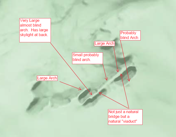
Reference: Seth Yancy
"a complex of natural bridges some of which form a natural viaduct that you could drive a semi under it". Located in Ed Carter unit of North Cumberland WMA.
Seth's annotated bing map
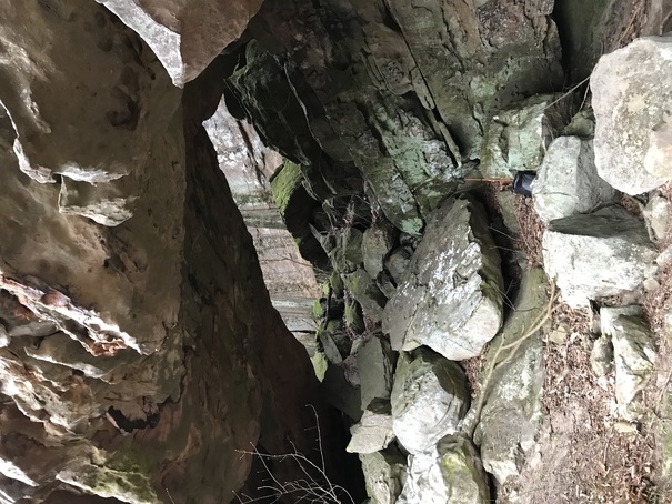
Photos from ganderson018:
 65x30
65x30
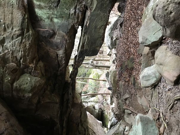 double arch, 65x15
ganderson018 reports: "I recently visited Viaduct Complex and it is amazing. Unlike other arches in the area, there is no spray paint or ATV destruction. The two "large arches" are 60 to 70 feet in length. The double arch (see photo) is 15 feet tall; the other is 30 feet tall. The "almost blind arch" and the "probably blind arch" both have significant light openings at the rear. The "probably blind arch" has a span of nearly 100 feet but a rear light opening of only 10 to 15 feet."