Tennessee Landforms -- arches and natural bridges| WGS84 |
| 36.444000 | -84.058520 |
| 36° 26.64'N | 84° 3.511'W |
| 36° 26' 38.4"N | 84° 3' 30.7"W |
| 16S 763649E 4037219N |
| convert to NAD27 |
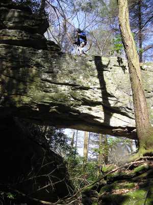
Three Bridges 70x25
Waypoint: CAA011 36.444000,-84.058520
County: Campbell landforms of Campbell county
Locale: private
NABSQNO 16S-763649-4037219
popup list of
nearby landforms (mileage, bearing)
MAPS
Select one of the following maps to display this waypoint (WGS84).
GPS
Remarks:
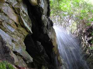
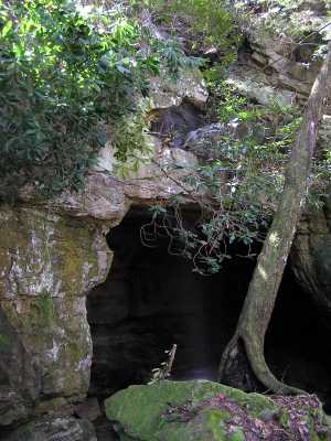
Three natual bridges on one creek.
Waterfall passes over small rib (10'), then behind and under large
span (50'x30'), then the creek passes under large (70'x25') natural bridge.
McCloud Mounatin
Tennessee landforms
home
arches
waterfalls
rocks
peaks
balds
sinks
lakes
regions
county
GSMNP landforms (TN/NC)
BSF landforms (TN/KY)
or nearby
lookout towers
 ©
Tom Dunigan
©
Tom Dunigan