Tennessee Landforms -- waterfalls| WGS84 |
| 35.608290 | -83.668592 |
| 35° 36.497'N | 83° 40.116'W |
| 35° 36' 29.8"N | 83° 40' 7"W |
| 17S 258274E 3943782N |
| convert to NAD27 |
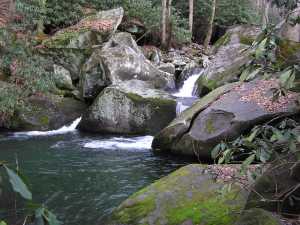
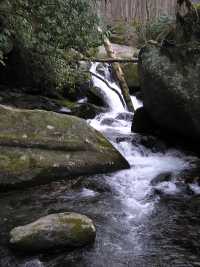
Sams Creek Cascade 20'
Waypoint: BTF035 35.608290,-83.668592
County: Blount landforms of Blount county
Locale: Great Smoky Mountains National Park
popup list of
nearby landforms (mileage, bearing)
MAPS
Select one of the following maps to display this waypoint (WGS84).
GPS
Remarks:
Reference: Byron Hartzler
Tennessee landforms
home
arches
waterfalls
rocks
peaks
balds
sinks
lakes
regions
county
GSMNP landforms (TN/NC)
BSF landforms (TN/KY)
or nearby
lookout towers
 ©
Tom Dunigan
©
Tom Dunigan