Tennessee Landforms -- waterfalls| WGS84 |
| 35.641400 | -83.692000 |
| 35° 38.484'N | 83° 41.52'W |
| 35° 38' 29"N | 83° 41' 31.2"W |
| 17S 256254E 3947514N |
| convert to NAD27 |
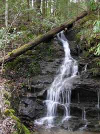
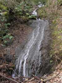
Loan Branch Cascade 9'
Waypoint: BTF023 35.641400,-83.692000
County: Blount landforms of Blount county
Locale: Great Smoky Mountains National Park
popup list of
nearby landforms (mileage, bearing)
MAPS
Select one of the following maps to display this waypoint (WGS84).
GPS
Remarks:
wet-weather falls along Middle Prong road.
Tennessee landforms
home
arches
waterfalls
rocks
peaks
balds
sinks
lakes
regions
county
GSMNP landforms (TN/NC)
BSF landforms (TN/KY)
or nearby
lookout towers
 ©
Tom Dunigan
©
Tom Dunigan