| WGS84 | |
| 36.216400 | -84.128900 |
| 36° 12.984'N | 84° 7.734'W |
| 36° 12' 59"N | 84° 7' 44"W |
| 16S 758089E 4011773N | |
| convert to NAD27 | |
MAPS
Select one of the following maps to display this waypoint (WGS84).
GPS
Remarks:
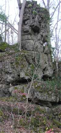
Several chimneys are located at the northen end of the wildflower trail. This is private property but open to the public at designated times. A number of arches are in the "gardens" as well as north across the creek and above the bluff.