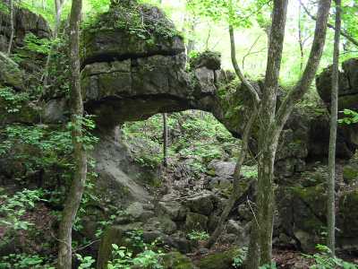
 the main arch 20x10
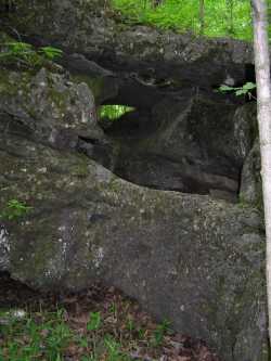
 5x3 arch just up the hill from main arch
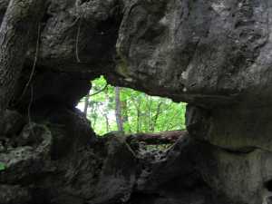
 small triple arch to the northwest of main arch
| WGS84 | |
| 36.175750 | -84.135820 |
| 36° 10.545'N | 84° 8.149'W |
| 36° 10' 32.7"N | 84° 8' 8.9"W |
| 16S 757601E 4007244N | |
| convert to NAD27 | |
MAPS
Select one of the following maps to display this waypoint (WGS84).
GPS
Remarks:
Reference: Keith Garnes
A collection of limestone arches in the same geologic formation as the Lovely Bluff/Savage Gardens complex.
the main arch 20x10
5x3 arch just up the hill from main arch
small triple arch to the northwest of main arch