Tennessee Landforms -- arches and natural bridges| WGS84 |
| 36.028500 | -84.268200 |
| 36° 1.71'N | 84° 16.092'W |
| 36° 1' 42.6"N | 84° 16' 5.5"W |
| 16S 746151E 3990563N |
| convert to NAD27 |
North Ribs (2) 3x1
Waypoint: ANA006 36.028500,-84.268200
County: Anderson landforms of Anderson county
Locale: trail
NABSQNO 16S-746151-3990563
popup list of
nearby landforms (mileage, bearing)
MAPS
Select one of the following maps to display this waypoint (WGS84).
GPS
Remarks:
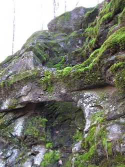
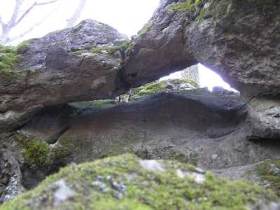
Two small rock ribs along the
North Ridge trail.
Waypoint is for the first rib, second rib is at
36.03464,-84.25783
Tennessee landforms
home
arches
waterfalls
rocks
peaks
balds
sinks
lakes
regions
county
GSMNP landforms (TN/NC)
BSF landforms (TN/KY)
or nearby
lookout towers
 ©
Tom Dunigan
©
Tom Dunigan