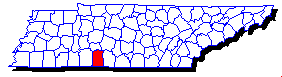
| Waypoint | Landform | Locale |
| LWF001 | Copperas Falls 20' | |
| LWF003 | Crockett Falls 5' | state park |
| LWF002 | Marcella Falls | private |
| LWF005 | Tanyard Br Falls 20' | private |
| LWF004 | Wilburn Mills Falls | private |
| LWL004 | David Crockett Lake | state park |
| LWL001 | Laurel Hill Lake | |
| LWL002 | Lourdes Lake | |
| LWL003 | VFW Lake |
For your GPS, download county wapoint file Lawrence.gpx or Lawrence.mxf
 Learn more about GPS software.
For example, use
EasyGPS (free) to upload the waypoints
from your PC to your GPS.
Learn more about GPS software.
For example, use
EasyGPS (free) to upload the waypoints
from your PC to your GPS.