Great Smoky Mountains National Park Landforms| WGS84 |
| 35.592600 | -83.633000 |
| 35° 35.556'N | 83° 37.98'W |
| 35° 35' 33.4"N | 83° 37' 58.8"W |
| 17S 261452E 3941955N |
| convert to NAD27 |
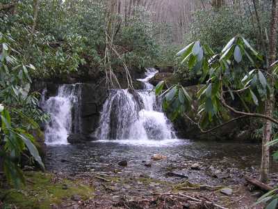
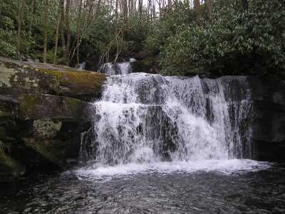
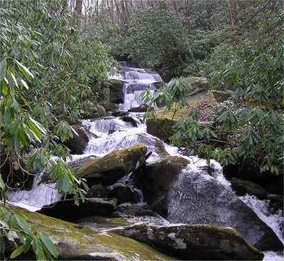
Indian Flats Falls 60'
Waypoint: SVF012 35.592600,-83.633000
Locale: Sevier
popup list of
nearby landforms/campsites (mileage, bearing)
MAPS
Select one of the following maps to display this waypoint (WGS84).
GPS
Remarks:
A manway leads to four falls.
GSMNP landforms and campsites
and
trails (TN/NC)
 AT shelters
BSF landforms (TN/KY)
AT shelters
BSF landforms (TN/KY)
Tennessee landforms
home
arches
waterfalls
rocks
peaks
balds
sinkholes
lakes
regions
 ©
Tom Dunigan
©
Tom Dunigan