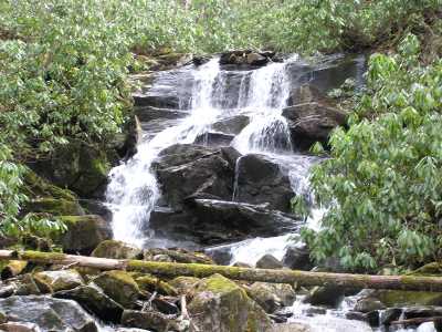 lower falls (elevation 4500')
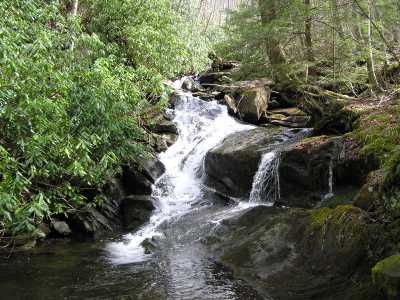 middle cascade (elevation 4700')
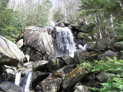 upper cascade (elevation 5200')
| WGS84 | |
| 35.589170 | -83.485280 |
| 35° 35.35'N | 83° 29.117'W |
| 35° 35' 21"N | 83° 29' 7"W |
| 17S 274829E 3941226N | |
| convert to NAD27 | |
MAPS
Select one of the following maps to display this waypoint (WGS84).
GPS
Remarks:
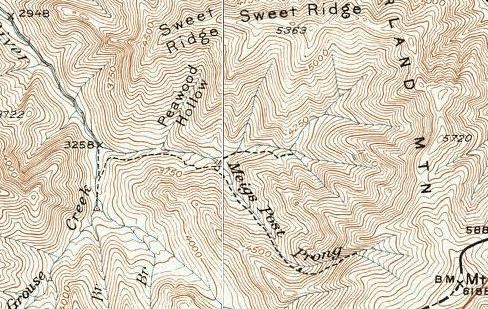
50' lower falls, several middle cascades, the waypoint is for
the top of the 400' upper cascade.
off-trail (see 1931 map)
lower falls (elevation 4500')
middle cascade (elevation 4700')
upper cascade (elevation 5200')
Named after an early surveyor (1700's).
nearby is Meigs Post Falls
 AT shelters
BSF landforms (TN/KY)
AT shelters
BSF landforms (TN/KY)