| WGS84 | |
| 35.610000 | -83.430200 |
| 35° 36.6'N | 83° 25.812'W |
| 35° 36' 36"N | 83° 25' 48.7"W |
| 17S 279877E 3943412N | |
| convert to NAD27 | |
MAPS
Select one of the following maps to display this waypoint (WGS84).
GPS
Remarks:
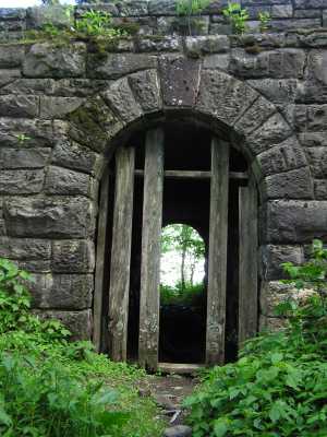
Man-made passage under road to Clingman's Dome, presumably intended to let horses pass under the road, but the old trails (see topo map) are no longer in use. (Or a secret border crossing between Tennessee and North Carolina :-)
Also see old Dutch Roth black&white
 AT shelters
BSF landforms (TN/KY)
AT shelters
BSF landforms (TN/KY)