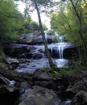
 Johnny Johnston's photo
| WGS84 | |
| 35.547320 | -83.514334 |
| 35° 32.839'N | 83° 30.86'W |
| 35° 32' 50.3"N | 83° 30' 51.6"W |
| 17S 272077E 3936650N | |
| convert to NAD27 | |
MAPS
Select one of the following maps to display this waypoint (WGS84).
GPS
Remarks:
Reference: google aerial imagery, off-trail
Johnny Johnston's photo
 AT shelters
BSF landforms (TN/KY)
AT shelters
BSF landforms (TN/KY)