| WGS84 | |
| 35.592230 | -83.266980 |
| 35° 35.534'N | 83° 16.019'W |
| 35° 35' 32"N | 83° 16' 1.1"W |
| 17S 294618E 3941088N | |
| convert to NAD27 | |
MAPS
Select one of the following maps to display this waypoint (WGS84).
GPS
Remarks:
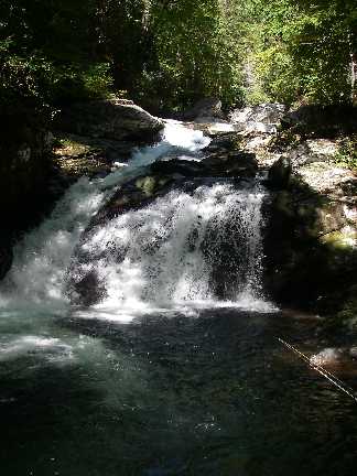
Reference and photo: James Locke
Mike Tyson's Punchout, 80' drop over 30 yards
 AT shelters
BSF landforms (TN/KY)
AT shelters
BSF landforms (TN/KY)