Great Smoky Mountains National Park Landforms| WGS84 |
| 35.581300 | -83.351500 |
| 35° 34.878'N | 83° 21.09'W |
| 35° 34' 52.7"N | 83° 21' 5.4"W |
| 17S 286931E 3940055N |
| convert to NAD27 |
Cliff Branch Falls 12'
Waypoint: NCF028 35.581300,-83.351500
Locale: NC
popup list of
nearby landforms/campsites (mileage, bearing)
MAPS
Select one of the following maps to display this waypoint (WGS84).
GPS
Remarks:
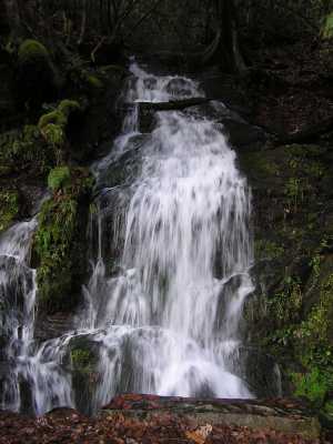
right off 441
GSMNP landforms and campsites
and
trails (TN/NC)
 AT shelters
BSF landforms (TN/KY)
AT shelters
BSF landforms (TN/KY)
Tennessee landforms
home
arches
waterfalls
rocks
peaks
balds
sinkholes
lakes
regions
 ©
Tom Dunigan
©
Tom Dunigan