Great Smoky Mountains National Park Landforms| WGS84 |
| 35.696500 | -83.193300 |
| 35° 41.79'N | 83° 11.598'W |
| 35° 41' 47.4"N | 83° 11' 35.9"W |
| 17S 301553E 3952504N |
| convert to NAD27 |
Gunter Fork Falls 13'
Waypoint: NCF024 35.696500,-83.193300
Locale: NC
popup list of
nearby landforms/campsites (mileage, bearing)
MAPS
Select one of the following maps to display this waypoint (WGS84).
GPS
Remarks:
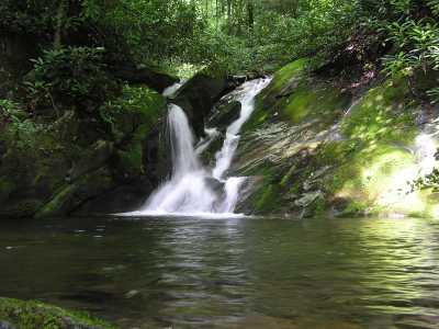
just upstream is the cascade
GSMNP landforms and campsites
and
trails (TN/NC)
 AT shelters
BSF landforms (TN/KY)
AT shelters
BSF landforms (TN/KY)
Tennessee landforms
home
arches
waterfalls
rocks
peaks
balds
sinkholes
lakes
regions
 ©
Tom Dunigan
©
Tom Dunigan