Great Smoky Mountains National Park Landforms| WGS84 |
| 35.544910 | -83.583020 |
| 35° 32.695'N | 83° 34.981'W |
| 35° 32' 41.7"N | 83° 34' 58.9"W |
| 17S 265842E 3936544N |
| convert to NAD27 |
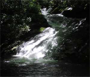
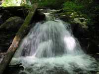
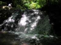
Hazel Creek Cascade
Waypoint: NCF005 35.544910,-83.583020
Locale: NC
popup list of
nearby landforms/campsites (mileage, bearing)
MAPS
Select one of the following maps to display this waypoint (WGS84).
GPS
Remarks:
A series of falls and cascades.

GSMNP landforms and campsites
and
trails (TN/NC)
 AT shelters
BSF landforms (TN/KY)
AT shelters
BSF landforms (TN/KY)
Tennessee landforms
home
arches
waterfalls
rocks
peaks
balds
sinkholes
lakes
regions
 ©
Tom Dunigan
©
Tom Dunigan