| WGS84 | |
| 35.549790 | -83.172200 |
| 35° 32.987'N | 83° 10.332'W |
| 35° 32' 59.2"N | 83° 10' 19.9"W |
| 17S 303103E 3936186N | |
| convert to NAD27 | |
MAPS
Select one of the following maps to display this waypoint (WGS84).
GPS
Remarks:
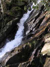
hard to photograph. a view of the falls from road is possible in winter.
 AT shelters
BSF landforms (TN/KY)
AT shelters
BSF landforms (TN/KY)