Great Smoky Mountains National Park Landforms| WGS84 |
| 35.760323 | -83.237960 |
| 35° 45.619'N | 83° 14.278'W |
| 35° 45' 37.1"N | 83° 14' 16.7"W |
| 17S 297673E 3959675N |
| convert to NAD27 |
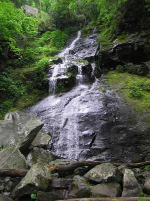
Hen Wallow Falls 45'
Waypoint: COF001 35.760323,-83.237960
Locale: Cocke
popup list of
nearby landforms/campsites (mileage, bearing)
MAPS
Select one of the following maps to display this waypoint (WGS84).
GPS
Remarks:
more
info.
GSMNP landforms and campsites
and
trails (TN/NC)
 AT shelters
BSF landforms (TN/KY)
AT shelters
BSF landforms (TN/KY)
Tennessee landforms
home
arches
waterfalls
rocks
peaks
balds
sinkholes
lakes
regions
 ©
Tom Dunigan
©
Tom Dunigan