 USGS benchmark (but no datasheet online??)
| WGS84 | |
| 35.568500 | -83.706300 |
| 35° 34.11'N | 83° 42.378'W |
| 35° 34' 6.6"N | 83° 42' 22.7"W |
| 17S 254736E 3939461N | |
| convert to NAD27 | |
MAPS
Select one of the following maps to display this waypoint (WGS84).
GPS
Remarks:
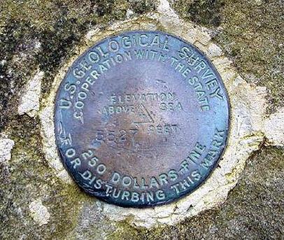
A USGS benchmark disk notes the elevation as 5527' at the marker. The USGS DEM elevation server (10m) reports high point of 5533.7' at 35.56862,-83.70622. The recent NC LiDAR survey reports high point of 5524.75' at 35.56862,-83.70622. The benchmark is in the trail, and the terrain is slighlty higher to the south. In 2014, NED 10m data has high point of 5529.17' at 35.568435,-83.706313. Wikipedia info. Blount County high point.
Rocky Top is down the AT to the west.
USGS benchmark (but no datasheet online??)
 AT shelters
BSF landforms (TN/KY)
AT shelters
BSF landforms (TN/KY)