| WGS84 | |
| 35.635470 | -83.746040 |
| 35° 38.128'N | 83° 44.762'W |
| 35° 38' 7.7"N | 83° 44' 45.7"W |
| 17S 251341E 3946991N | |
| convert to NAD27 | |
MAPS
Select one of the following maps to display this waypoint (WGS84).
GPS
Remarks:
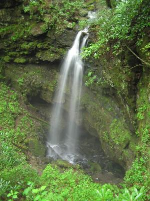
A small stream falls 40 feet directly into the mouth of a cave (off-trail/manway).
geology info and pics
 AT shelters
BSF landforms (TN/KY)
AT shelters
BSF landforms (TN/KY)