Great Smoky Mountains National Park Landforms| WGS84 |
| 35.644330 | -83.807580 |
| 35° 38.66'N | 83° 48.455'W |
| 35° 38' 39.6"N | 83° 48' 27.3"W |
| 17S 245795E 3948132N |
| convert to NAD27 |
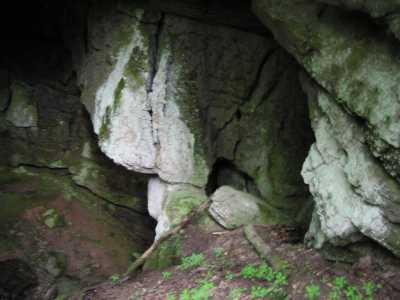
Bull Rib 12x20
Waypoint: BTA006 35.644330,-83.807580
Locale: Blount
popup list of
nearby landforms/campsites (mileage, bearing)
MAPS
Select one of the following maps to display this waypoint (WGS84).
GPS
Remarks:
Limestone span over cave entrance.
GSMNP landforms and campsites
and
trails (TN/NC)
 AT shelters
BSF landforms (TN/KY)
AT shelters
BSF landforms (TN/KY)
Tennessee landforms
home
arches
waterfalls
rocks
peaks
balds
sinkholes
lakes
regions
 ©
Tom Dunigan
©
Tom Dunigan