
| WGS84 | |
| 35.637000 | -83.748870 |
| 35° 38.22'N | 83° 44.932'W |
| 35° 38' 13.2"N | 83° 44' 55.9"W |
| 17S 251090E 3947168N | |
| convert to NAD27 | |
MAPS
Select one of the following maps to display this waypoint (WGS84).
GPS
Remarks:
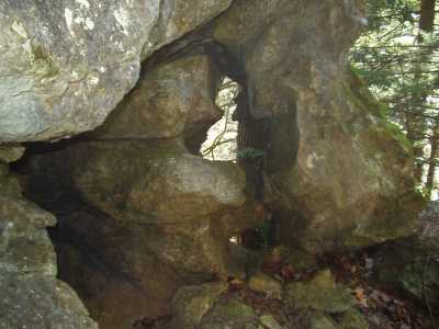
A couple of small windows high on the west edge of the rock wall in Whiteoak Sinks. Not signficant in themselves, but if you're in the sink visiting the sinkholes, falls, and caves, you might as well search these out. See geology info and pics
Offtrail/manway.
 AT shelters
BSF landforms (TN/KY)
AT shelters
BSF landforms (TN/KY)