
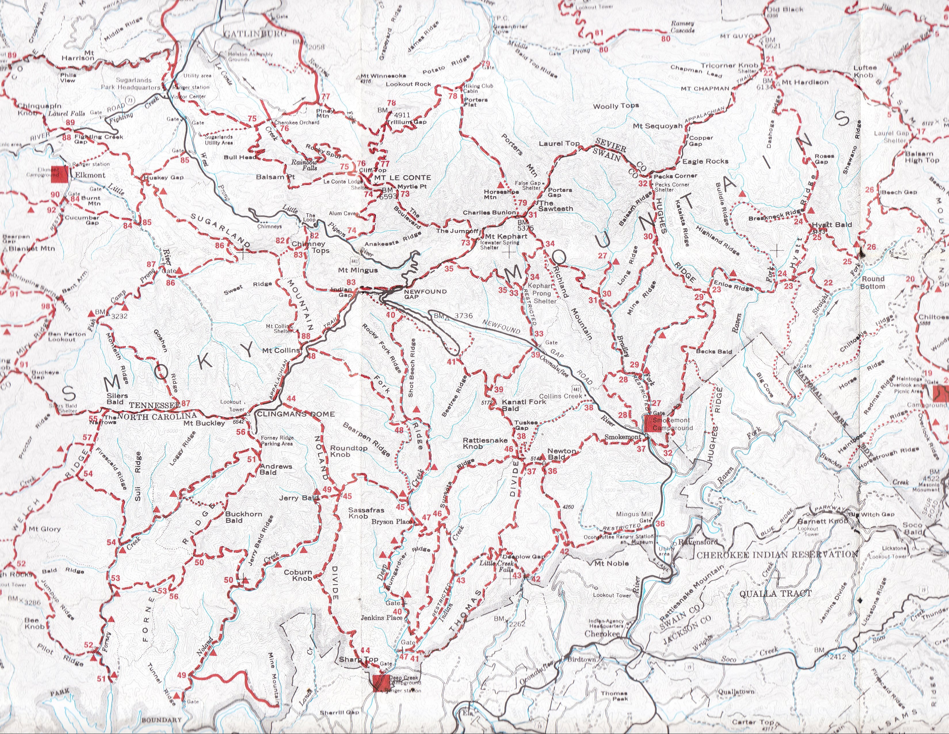
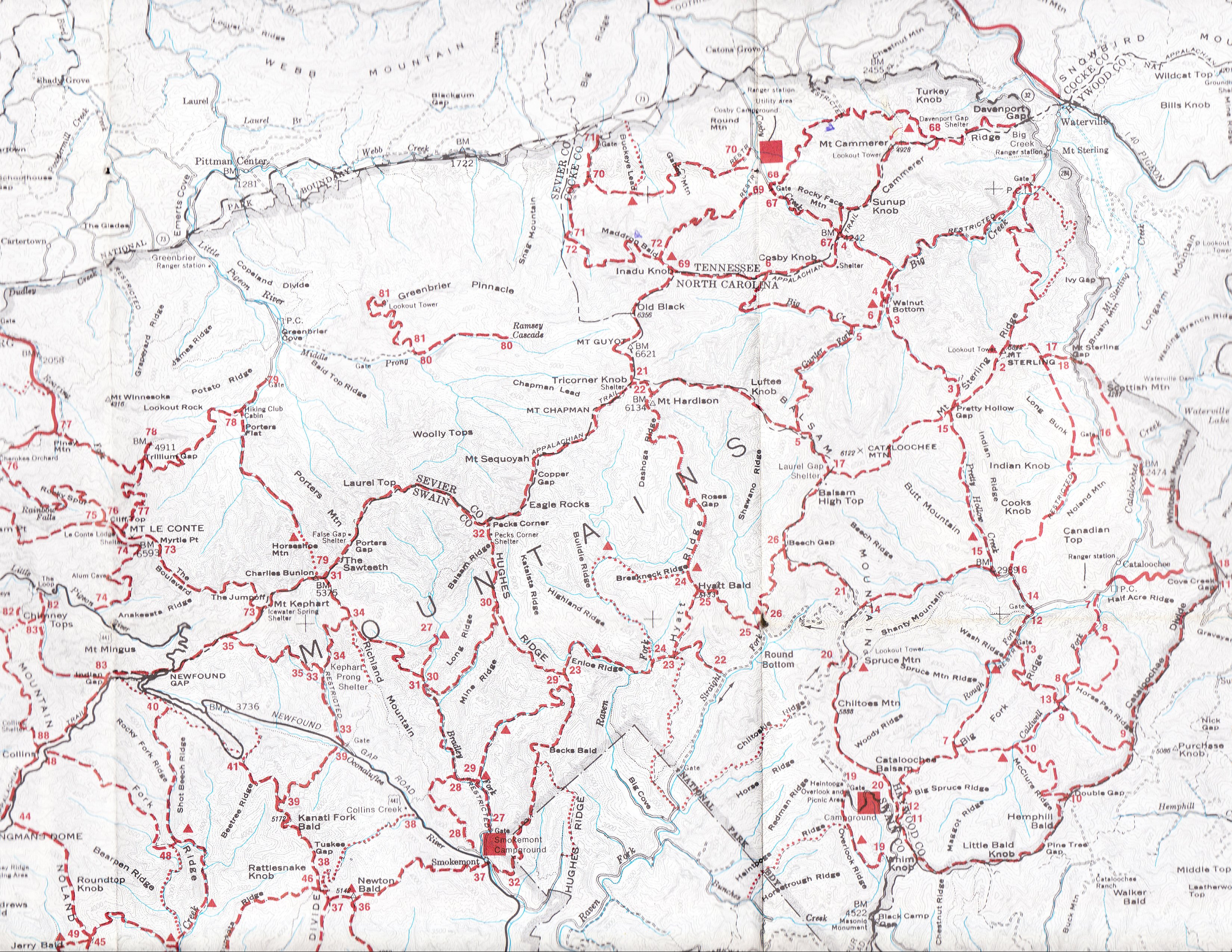
| Great Smoky Mountains clickable trail/topo map (1974) |
Click on the 1974 trail map below to zoom and pan
This 1979? (really 1974) National Park Service GSMNP trail/topo map is from the Library of Congress GSMNP map collection and is the basis of the Smokies "blue book" map. The latitude/longitude calibration of this map is only approximate, use the topo maps for more accurate coordinates. Also see scanned version: west middle east
GSMNP
hiking trails mileage, climb, elevation profiles, and map locator
and stream crossings
GSMNP landforms and campsites
maps and GPS waypoints
AT shelters 
Tennessee landforms
home
arches
waterfalls
rocks
peaks
balds
sinkholes
lakes
regions
county
Visits since 7/11/09