single-track no longer maintained
As of Spring, 2019, TWRA is no
longer allowing volunteers to maintain the single-track trails in Borce
(Dove, Gray Fox, Twisted Beech, Gheen)
The area is closed for three spring weekend turkey hunts. For 2025, the area is closed April 5-6 and 13-14 and scout day 7 a.m. to noon March 29. See reservation hunt info. The Black Oak Ridge trails are closed for Oak Ridge 2025 fall deer hunts Nov 1-2, 8-9, Dec 13-14, see reservation hunt info. In addition, the area is closed the Saturday before each scheduled hunt weekend for scouting.
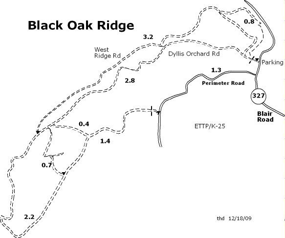
Description: The Black Oak Ridge Conservation Easement (BORCE) was opened to the public in October of 2007. The Dyllis Orchard Road Hiking Trail provides access to approximately eleven miles of trail on gravel roads, which are considered moderately difficult. The trail is open daily from daylight to dusk, and is limited to hikers and bicyclists. No motorized vehicles or animals are permitted, with the exception of motorized wheelchairs and service animals. Additional trails are under design. See easement map (pdf) and Oak Ridger article.
Black Oak Ridge Conservation Easement includes 3,073 acres on Black Oak Ridge and McKinney Ridge in the western part of Oak Ridge. The Tennessee Department of Environment and Conservation, the Tennessee Wildlife Resources Agency and DOE manage the site. It contains interesting community types and species such as hemlock-rhododendron forest, beech maple forest, cedar barrens, fringe tree, spider lily, spreading false-foxglove, white-topped sedge, Vaseys trillium, Tennessee dace and southeastern shrew. Some of these species are unusual for the Ridge and Valley region.
If you go out on the Perimeter Road pavement, you can make a loop of 8.0 miles. You can do a figure-8 of about 8.8 miles or a smaller 5.3 mile loop. Some of the gravel sections are steep ( 26% grade). West Ridge Road is not maintained as frequently as other sections. See trail map or Google map. In 2009, another 0.8 miles of trail were opened in the NE corner, 0.3 gravel road plus 0.5 miles of single-track (Twisted Beech Trail). Here is GPS summary (map, elevation profile) of 9.7 mile figure-8 including Twisted Beech single track, 1150' cumulative climb. And a 9-mile loop with 1050' climb.
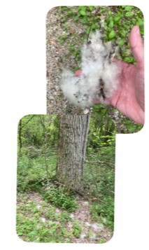
In January 2011 two more single-track trails were added. And in 2015, another 1.7 miles of single-track (Gheen trail) was added off of Twisted Beech (thanks to Larry Creech and Doug Colclasure). See updated trail map or Google map above. See GPS track of ride down western single track (Gray Fox trail 1.25 miles) and up eastern single track (Dove trail 0.75 miles). In April/May white fluff of eastern cottonwood at lower junction of Gray Fox trail.
It is 1.5 miles down Blair Road to the Wheat trail entrance that connects in 1.1 miles with the North Boundary trails. An additional 1.3 miles of single-track has been added along McKinney Ridge (foot traffic only).
For more info on Oak Ridge, visit the Oak Ridge Visitors Bureau.