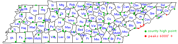
| Tennessee county high points |
| county | elevation | landmark |
| Anderson | 3529' | Cross Mtn |
| Bedford | 1357' | Bedford |
| Benton | 680' | Round Top |
| Bledsoe | 2680' | Holloway Ridge |
| Blount | 5527' | Thunderhead |
| Bradley | 1495' | Ooltewah Tower |
| Campbell | 3534' | Cross Mtn |
| Cannon | 2095' | Short Mtn |
| Carroll | 711' | Maple Cr Tower |
| Carter | 6285' | Roan High Knob |
| Cheatham | 900' | Cheatham |
| Chester | 740' | Sand Mtn |
| Claiborne | 3200' | Bryson Mtn |
| Clay | 1410' | Pilot Knob |
| Cocke | 6370' | Old Black |
| Coffee | 2027' | Henry Cove |
| Crockett | 484' | Broadview |
| Cumberland | 3048' | Hinch Mtn |
| Davidson | 1160' | Davidson |
| Decatur | 708' | Carmel |
| DeKalb | 1220' | DeKalb |
| Dickson | 960' | Pond Reset |
| Dyer | 516.6' | Millsfield LiDAR |
| Fayette | 677' | Gordon Hill |
| Fentress | 1872' | Clarkrange 2 |
| Franklin | 2039' | Sewanee |
| Gibson | 574' | Medina |
| Giles | 1170' | Parish Hollow |
| Grainger | 2534' | Clinch Mtn |
| Greene | 4846' | Gravel Knob |
| Grundy | 2384' | Lockhart Tower sw |
| Hamblen | 1952' | Crockett Ridge |
| Hamilton | 2153' | Lookout Mtn |
| Hancock | 2630' | Clinch Mtn |
| Hardeman | 694' | Hickory Valley |
| Hardin | 845' | Hardin |
| Hawkins | 3118' | Chimney Top Mtn |
| Haywood | 500' | Sammons Cemetery |
| Henderson | 708' | Life |
| Henry | 653' | Old Anitoch W |
| Hickman | 980' | Bon Aqua Tower |
| Houston | 865' | Van Hook |
| Humphreys | 889' | Dickhum nc |
| Jackson | 1132' | Antioch |
| Jefferson | 3629' | English Mtn |
| Johnson | 5574' | Snake Mtn |
| Knox | 2091' | House Mtn |
| Lake | 325' | Cates |
| Lauderdale | 527' | Dry Hill |
| Lawrence | 1102' | Lawrence |
| Lewis | 1075' | Lewis |
| Lincoln | 1500' | Stovall Mtn |
| Loudon | 1313' | Alexander Knob |
| Macon | 1100' | Russell Hill |
| Madison | 664' | Madison |
| Marion | 2386' | county line |
| Marshall | 1289' | Neil Gap |
| Maury | 1176' | Flanigan Hill |
| McMinn | 2347' | Starr Mtn |
| McNairy | 688' | Mt Peter |
| Meigs | 1296' | McMinn Ridge |
| Monroe | 5470' | Haw Knob |
| Montgomery | 812' | Marion |
| Moore | 1267' | Warren Cem |
| Morgan | 3340' | Big Fodderstack |
| Obion | 551' | Old Fremont |
| Overton | 2025' | Hampton Mtn |
| Perry | 984' | Matheny Camp |
| Pickett | 1790' | Golman Mtn |
| Polk | 4215' | Big Frog |
| Putnam | 2060' | Putnam |
| Rhea | 2040' | Rhea |
| Roane | 2036' | Mt Roosevelt |
| Robertson | 930' | Water Tower |
| Rutherford | 1366' | Harrold Cem |
| Scott | 3268' | Guinea Hill Knob |
| Sequatchie | 2394' | Henson |
| Sevier | 6643' | Clingmans Dome |
| Shelby | 432' | Collierville |
| Smith | 1255' | Walnut Knob |
| Stewart | 771' | French Hollow |
| Sullivan | 4309' | Holston High Point |
| Sumner | 1085' | Wolf Hill |
| Tipton | 458' | Munford |
| Trousdale | 1104' | Trousdale |
| Unicoi | 5516' | Big Bald |
| Union | 2312' | Signal Point |
| VanBuren | 2142' | Smartt Mtn |
| Warren | 1980' | Warren |
| Washington | 3525' | Pinnacle Mtn |
| Wayne | 1086' | McCall |
| Weakley | 600' | Weakley |
| White | 2017' | Chestnut Mtn |
| Williamson | 1253' | Pull Tight |
| Wilson | 1363' | Wilson |
In the table, click on the county name to view the Google map and get a list of maps for that point. At the bottom of the table are waypoint files for uploading to your GPS. Latitude and longitude are in the WGS84 datum and extrapolated from USGS 7.5' topo maps or provided by the DEM data.
Andy writes:

White   spot elevation 2 miles east of DeRossett        2,009   DeRossett
        16 areas within 2 miles of 2009 spot elevation  2,000+  DeRossett
        9 areas within 1 1/4 miles of Stringtown        2,000+  DeRossett
We have used 10m USGS/NASA digital elevation data
(quad/UTM DEMs
or better
seamless server)
to resolve the multi high point counties.
For White county,
the 10m DEM shows the high point
(35.87875 -85.31523) at 2010'.
(See Google map with DEM grid
over candidates -- zoom out to see all areas.)
Another candidate, was the
contour with the 2009' spot elevation, but
the DEM data reported only 2005.9 for the high point in that contour.
 In 2016, TN did additional
LiDAR elevation surveys that included White county.
From the TN LiDAR DEM data, the digital high point for White county is 2017.2'
at
35.878792,-85.315431. The next closest contour is at 2013.2'
at 35.886713,-85.303809.
In 2016, TN did additional
LiDAR elevation surveys that included White county.
From the TN LiDAR DEM data, the digital high point for White county is 2017.2'
at
35.878792,-85.315431. The next closest contour is at 2013.2'
at 35.886713,-85.303809.
As another example, see the 10m DEM grid over the two candidate areas for Sullivan county. The Rutherford county high points illustrate points on the county line -- digital high point 1366.8' near Brown Cemetery. Or is that in the adjacent county, how accurate is the line on the topo map? The 10m DEM high point might actually be 1366.7' near Harrold Cemetery. From the 2004 LiDAR survey of Rutherford county, the high point is 1366' at Harrold Cemetery 35.71839,-86.23124. The 10m DEM data revealed a high point (35.21757 -89.7475) for Shelby county that was not on Andy's list -- and at 432'. Tom Owen reports this is a man-made (overpass), so we have not listed it as the high point. On the other hand, we did find some bad DEM (or topo?) data in the Dyersburg quad in Dyer county, TN. Topo map has a couple of 500 and 510 contours and one 515 spot elevation. The max elevation from the 10m DEM for the quad is only 476' (at the 515 spot elevation). See visual evidence. The 2016 DEM data from seamless server has the spot elevation at 509.4' at 36.071538,-89.494581, and further north 512.3' at 36.104059,-89.491718 Looking at the satellite image, it's possible the high point has been bull-dozed down. TN LiDar (2012) has Dyer county high point at 36.143024,-89.382625 (516.6'), the former Millsfield fire tower site.
Henry and Lake county had no quad-based 10m DEM data for the areas of interest, but USGS seamless server had 3m DEM data for both Henry and Lake county. (Example: Lake County, view the map, and see the new HP is the southwest cluster of red +'s. If you zoom in and switch to satellite view, you'll see they probably built a hill for the water tank!) This 3m data is based on LiDAR (see bullet list below), but LiDAR elevation data for TN is presently only available for a few areas: Anderson county, Rutherford county (2004), Hamilton County, Davidson County, City of Franklin, Smoky Mountain, along the Mississippi and the NC boundary (see map or enable the "Elevation Availability" layer in the national map viewer). TN GIS in 2011 developed a LiDAR business plan and technical specs for conducting TN LiDAR survey (12.5 cm veritcal RMSE at 1m spacing) at $10.4 million (2014-2018). From recent LiDAR data, strip mining has eliminated Burge Mountain as the Scott County digital high point, being replaced by Guinea Hill Knob.
Thunderhead Mountain, Blount County high point, has a USGS benchmark disk that reports elevation of 5527' (no USGS datasheet?). The USGS DEM data lists the Thunderhead high point as 5533.7' at 35.56862,-83.70622. The recent NC LiDAR survey reports high point of 5524.75' at 35.56862,-83.70622 (bare earth).
SRTM data (30m) is also available from earthexplorer.usgs.gov and is more recent (2000), but is based on "first-return" data and may have inaccuracies. (Example: cohp'ers visiting Bryson Mtn (Claiborne county) noted that summit (3200') had been reduced by stripmining. Neither the 30m or 10m DEM data revealed this, but the SRTM data did (3117'), see map or use the track elevation profile on the cohp google map.) I am now using the seamless server for the source of elevation data. Also Google Earth seems to have fairly accurate elevation data (10m DEM or 30m SRTM?), and we have a coarse (30m SRTM) elevation profile tool on our Google high points map along with 10m (and in some cases 3m LiDAR) spot elevations.
The highest point in TN is Clingmans Dome at 6,643', and the lowest point is 188' along the Mississippi. (Elevation profile from Memphis to Clingman's Dome.) The Tennessee county high points have one "twofer", a single high point that serves two counties: Marion and Sequatchie at Lockhart. Anderson and Campbell county mostly share a high point, though the Cross Mountain benchmark (high point) is in Campbell county. The 2015 TN LiDAR elevation survey has Cross Mountain high point (3534.2') at 36.198266,-84.230993. Here is a nice article from the Tennessee Conservationist magazine on Tennessee's high points (1999).
Sevier county has the maximum elevation differential -- Clingmans Dome (6643') to the French Broad River (839'). Lake County has least relief (82'). The following table lists the relief for a few counties. The low points have not been located with the greatest rigor. County low points usually occur at a river or creek drainage on the county border. Rhea County low point is in a quarry at 35.538287,-84.898657. You can view the low point by pasting the lat,lon into the Find box of the Google map.
| County | High | Low | relief | low @ |
|---|---|---|---|---|
| Anderson | 3529' | 759' | 2770' | 36.023053,-84.333294 |
| Davidson | 1160' | 385' | 775' | 36.209993,-86.985376 |
| Hamilton | 2153' | 634' | 1519' | 35.120353,-85.391910 |
| Knox | 2091' | 795' | 1296' | 35.897173,-84.264052 |
| Lake | 325' | 243' | 82' | 36.185381,-89.629308 |
| Madison | 664' | 304' | 360' | 35.688542,-89.069661 |
| Montgomery | 812' | 352' | 460' | 36.418739,-87.602203 |
| Putnam | 2060' | 505' | 1555' | 36.248223,-85.776826 |
| Rutherford | 1366' | 490' | 876' | 36.068296,-86.561677 |
| Sevier | 6643' | 839' | 5804' | 35.944067,-83.694747 |
| Shelby | 432' | 188' | 244' | 34.996043,-90.305450 |
| Sullivan | 4309' | 1151' | 3158' | 36.526282,-82.613369 |
| Media | Accuracy |
|---|---|
| topo contours | 1/2 contour |
| spot elevation | 1/3 contour |
| benchmark | 0.02 m |
| ASTER | 11 m |
| SRTM | 10 m |
| DEM | 7 m |
| NED | 2.4 m |
| LiDAR | 0.15 m |
| photogrammetry | 0.09 m |
| EDM | 0.03 m |
| GPS/RTK | 0.012 m |
For reference, here are Andy's original TN county high point areas, courtesy of Tom Owen, and on Google map (includes new additions in Shelby and Lake County), and tnahps.gpx and tnahps.kmz. Andy has a demo Google map for various US county high points, includes gpx and kml data and link to trip reports, derived from Adam's cohp.org, another version of US county high points google map, or leafletjs version. Also, see US county high points ESRI map (too big for my free account), or US ArcGIS map
visits since 12/10/04
Tom Dunigan
-- revised
Thu, 29 Feb 2024 13:13:51 -0700