 NOAA weather near waypoint
or
wunderground
NOAA weather near waypoint
or
wunderground
| WGS84 | |
| 36.562960 | -84.658800 |
| 36° 33.778'N | 84° 39.528'W |
| 36° 33' 46.7"N | 84° 39' 31.7"W |
| 16S 709514E 4048943N | |
| convert to NAD27 | |
MAPS
Select one of the following maps to display this waypoint (WGS84).
NOAA weather near waypoint
or
wunderground
GPS
Remarks:
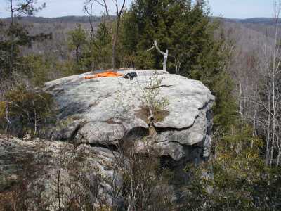
An old trail used to go out to this chimney. All the deadfall (pine beetle) make it more challenging. You step across to the top of the chimney.