 NOAA weather near waypoint
or
wunderground
NOAA weather near waypoint
or
wunderground
| WGS84 | |
| 36.563260 | -84.656600 |
| 36° 33.796'N | 84° 39.396'W |
| 36° 33' 47.8"N | 84° 39' 23.8"W |
| 16S 709710E 4048981N | |
| convert to NAD27 | |
MAPS
Select one of the following maps to display this waypoint (WGS84).
NOAA weather near waypoint
or
wunderground
GPS
Remarks:
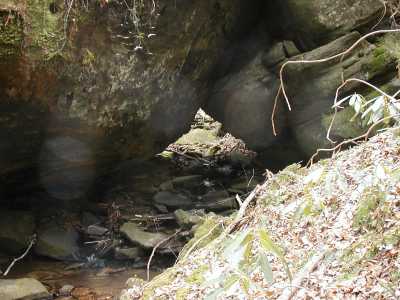
A gravity arch over a creek at the bottom of the hollow (off-trail).