NOAA weather near waypoint
or
wunderground
NOAA weather near waypoint
or
wunderground
| WGS84 | |
| 36.527600 | -84.754400 |
| 36° 31.656'N | 84° 45.264'W |
| 36° 31' 39.4"N | 84° 45' 15.8"W |
| 16S 701049E 4044815N | |
| convert to NAD27 | |
MAPS
Select one of the following maps to display this waypoint (WGS84).
NOAA weather near waypoint
or
wunderground
GPS
Remarks:
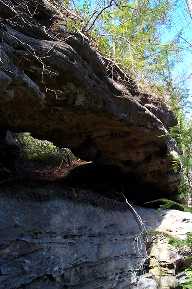 reference and photo courtesy of Todd Fife