NOAA weather near waypoint
or
wunderground
NOAA weather near waypoint
or
wunderground
| WGS84 | |
| 36.541880 | -84.743730 |
| 36° 32.513'N | 84° 44.624'W |
| 36° 32' 30.8"N | 84° 44' 37.4"W |
| 16S 701967E 4046422N | |
| convert to NAD27 | |
MAPS
Select one of the following maps to display this waypoint (WGS84).
NOAA weather near waypoint
or
wunderground
GPS
Remarks:
References: JNAD:TENN-21, Russ Manning
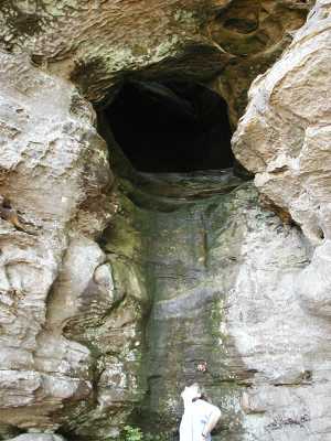
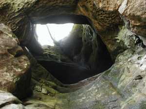
This vertical tunnel lies about a mile west of the twin arches on the trail to Jake's Place. There is also a small arch south of the trail about 0.8 miles from the twin arches.