 NOAA weather near waypoint
or
wunderground
NOAA weather near waypoint
or
wunderground
| WGS84 | |
| 36.727200 | -84.532900 |
| 36° 43.632'N | 84° 31.974'W |
| 36° 43' 37.9"N | 84° 31' 58.4"W |
| 16S 720314E 4067448N | |
| convert to NAD27 | |
MAPS
Select one of the following maps to display this waypoint (WGS84).
NOAA weather near waypoint
or
wunderground
GPS
Remarks:
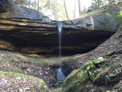 Chad Harrold photo