 NOAA weather near waypoint
or
wunderground
NOAA weather near waypoint
or
wunderground
| WGS84 | |
| 36.630623 | -84.696228 |
| 36° 37.837'N | 84° 41.774'W |
| 36° 37' 50.2"N | 84° 41' 46.4"W |
| 16S 705984E 4056369N | |
| convert to NAD27 | |
MAPS
Select one of the following maps to display this waypoint (WGS84).
NOAA weather near waypoint
or
wunderground
GPS
Remarks:
Reference and photo:Chad Benjamin
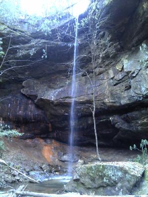 aka, Mark Branch Falls (Russ Manning)