Appalachian Trail Shelters| WGS84 |
| 39.93198 | -77.48638 |
| 39° 55.919'N | 77° 29.183'W |
| 39° 55' 55.1"N | 77° 29' 11"W |
| 18S 287541E 4423168N |
| convert to NAD27 |
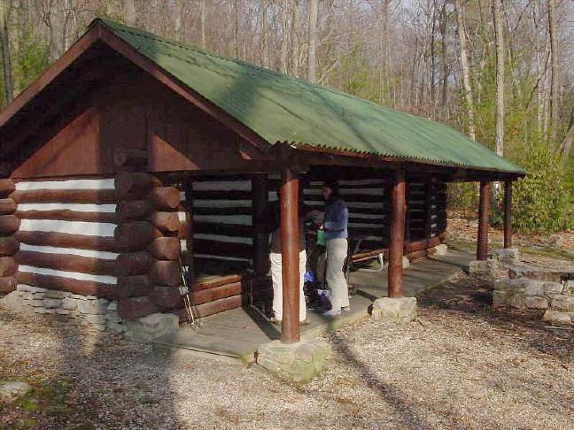
Quarry Gap Shelters 
Waypoint: QuarryGap 39.93198,-77.48638
County/State: Franklin PA
Elevation: 1455' or USGS elevation
1088.1 miles from Springer and 1109.3 miles to Katahdin
next shelter south ↓ 5.6 miles. next shelter north ↑ 7.4 miles. all shelters
popup list of
nearby shelters (mileage, bearing) (as the crow flies)
 NOAA weather near shelter
or
wunderground
NOAA weather near shelter
or
wunderground
MAPS
Select one of the following maps to display this waypoint (WGS84).

GPS
These maps, coordinates, and waypoint files are based on recent (2009)
Appalachian Trail
waypoints.
You can often find more information on a particular
shelter by visiting the AT
partners that maintains that section of trail.
For trail mileages between shelters go back to our
list of shelters.
AppalachianTrail.org has
the latest trail conditions, maps, and trail guides.
Additional information:
Notes: AT arrives at twin Quarry Gap Shelters; spring is located 10 yds north of shelte
USGS quad: CALEDONIA PARK
Δ elevation profile to next shelter north, cumulative climb/descent, (data provenance)
photo
AT shelters
GSMNP campsites
GSMNP landforms
BSF landforms
TN landforms
 ©
Tom Dunigan TNlandforms.US
©
Tom Dunigan TNlandforms.US